

New Insights into the Global Fishing Industry Revealed by Satellite Imagery and Machine Learning | Travel News
The worldwide fishing sector is often surrounded by secrecy, marked by a lack of transparency and insufficient data about the quantity of vessels and their operations. Nevertheless, recent progress in satellite imaging and machine learning has provided a more comprehensive perspective on this industry, revealing surprising realities that policymakers should take note of.
A team of researchers, in collaboration with various universities, led a groundbreaking investigation using two petabytes of orbital imagery spanning from 2017 to 2021. Through the analysis of this extensive data, millions of vessels at sea were identified and cross-referenced with reported coordinates from the automated identification system (AIS), commonly used in ship tracking.
The study's revelations were remarkable, indicating that roughly three-quarters of all industrial fishing vessels and nearly a third of transport and energy vessels operate without public tracking. This unveils the existence of a substantial "dark fishing" sector, almost double the size of the publicly documented one. The consequences of such covert operations are significant, undermining efforts to regulate and sustainably manage fish stocks.
While some vessels escape public tracking due to factors like limited satellite coverage or intentional evasion, addressing this lack of transparency is critical. Openly monitoring fishing vessels is crucial for effectively overseeing fish stocks and comprehending the ecological impact of fishing activities. Without comprehensive data, policies and scientific research in this domain will remain fundamentally flawed.
The study underscores the disparity in tracking levels across regions, revealing high tracking rates in Nordic countries like Iceland but nearly zero tracking in Southeast Asian nations such as Bangladesh, India, and Myanmar. This lack of transparency has led to a skewed representation of the Asian fishing industry in existing data.
The use of satellite imagery and machine learning allows policymakers, scientists, and authorities to gain valuable insights into the global fishing industry. Collaborating across regions to evaluate these new data maps is crucial, identifying areas needing further investigation and protection. This enhanced comprehension of fishing activities will facilitate evidence-based policies promoting sustainable practices and safeguarding marine ecosystems.
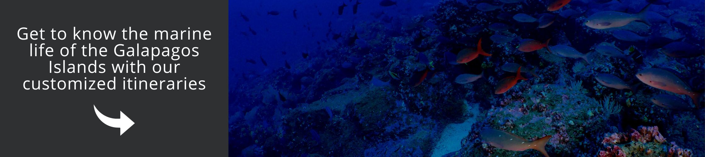
Satellite analysis has exposed alarming fishing activities in forbidden zones like the Galapagos Islands, emphasizing the urgent need for stricter enforcement and conservation measures according to international law.

While this study provides an exciting glimpse into the potential of satellite imagery and machine learning in understanding the global fishing industry, additional research and data analysis are necessary. Global Fishing Watch continues to process new radar imagery and update its open data platform, providing stakeholders with current information on fishing activities. Supported by philanthropic organizations and individuals, this nonprofit initiative aims to illuminate the intricate dynamics of the maritime industry and instigate positive change in global fisheries management.
Frequently Asked Questions
What progress has been achieved in comprehending the global fishing industry?
Recent developments in satellite imagery and machine learning have offered a more extensive understanding of the global fishing industry.
What were the findings of the study conducted by Global Fishing Watch?
The study disclosed that a notable proportion of industrial fishing vessels and transport and energy vessels operate without public tracking, pointing to the existence of a substantial "dark fishing" industry.
Why is the tracking of fishing vessels significant?
Transparently tracking fishing vessels is essential for overseeing fish stocks, comprehending the ecological impact of fishing activities, and implementing effective policies for sustainable fishing.
Which regions exhibit higher levels of vessel tracking?
Nordic nations, such as Iceland, display elevated levels of vessel tracking, whereas Southeast Asian countries like Bangladesh, India, and Myanmar show minimal tracking.
What valuable insights can be gleaned from satellite imagery and machine learning?
Satellite imagery and machine learning offer valuable insights into the global fishing industry, aiding in the formulation of evidence-based policies and the protection of marine ecosystems.
What did the satellite analysis indicate about protected areas?
The satellite analysis uncovered alarming fishing activities taking place in protected areas, like the Galapagos Islands, underscoring the necessity for more stringent enforcement and conservation measures.
What initiatives is Global Fishing Watch currently undertaking?
Global Fishing Watch is actively processing new radar imagery and updating its open data platform to furnish current information on fishing activities, contributing to the enhancement of global fisheries management.
Definitions
-
Orbital imagery: Pictures taken by satellites circling the Earth, commonly employed for surveillance and analytical purposes.
-
Automated identification system (AIS): A tracking system for ships utilizing transponders on vessels to broadcast details like their location, speed, and course.
-
Dark fishing: Denotes the undisclosed fishing operations of vessels that evade public tracking.